

Weather Report: Disruptive rain and thunderstorms across the Cape
Saturday brings a genuine split, sunny and mild in the interior, wet and stormy across the three Cape provinces. Here's the full picture.

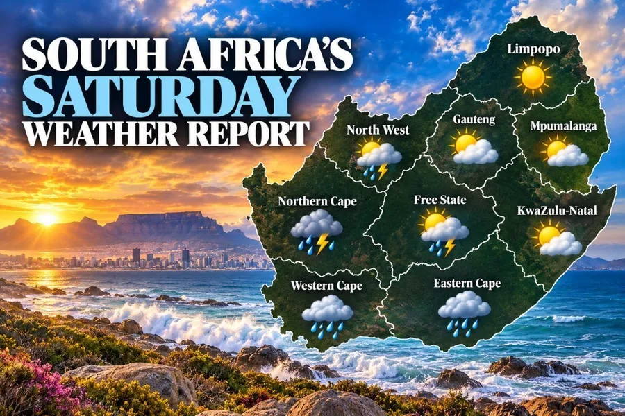
Saturday, 3 October’s Weather Report shows a real contrast across the country.
The interior enjoys a mild, mostly dry day, while the Northern Cape, Western Cape and Eastern Cape all face disruptive rain and thunderstorms.
The South African Weather Service (SAWS) has issued a Yellow Level 2 warning for severe thunderstorms and disruptive rain, covering the eastern parts of the central and eastern Northern Cape, the Beaufort West Municipality in the Western Cape, and the western parts of the Eastern Cape.
Gauteng enjoys a mostly clear day.
Johannesburg climbs from a chilly 9°C to a pleasant 22°C.
Pretoria is the warmest spot in the province, reaching 23°C, while Soweto and Vereeniging both sit at 22°C.
WHERE TODAY’S INTERIOR STAYS DRY AND MILD
North West stays partly cloudy and cool, turning cloudy in the afternoon with isolated showers and thundershowers in the west.
Mahikeng climbs from 10°C to 24°C under cloudy skies, while Rustenburg reaches 25°C.
The Free State stays overcast for much of the day.
Bloemfontein ranges from 10°C to 23°C, with Bethlehem reaching 24°C and a chance of slight rain.
Limpopo enjoys mostly clear skies. Polokwane climbs from 9°C to 19°C, while Tzaneen and Musina both reach 23°C.
Mpumalanga also stays mostly clear.
Mbombela climbs from 10°C to 21°C.
WHY THE THREE CAPE PROVINCES FACE TODAY’S HEAVIEST RISK
The Northern Cape sees showers and thundershowers across much of the interior.
Kimberley climbs from 13°C to 22°C, Upington reaches 25°C, and De Aar sits at 22°C. SAWS warns that heavy downpours, hail, excessive lightning and gusty winds could cause localised flooding of settlements, roads and bridges over the eastern parts of the province.
The Western Cape stays partly cloudy.
Cape Town sits between 13°C and 18°C, Stellenbosch reaches 18°C, and Paarl climbs to 20°C.
George faces slight rain. The same severe thunderstorm and disruptive rain warning applies specifically to the Beaufort West Municipality.
The Eastern Cape faces the wettest day of the weekend. Gqeberha sees rain showers with an 80% chance of rain, ranging from 15°C to 18°C.
East London holds steady around 20°C, with a 60% rain chance.
SAWS warns the disruptive rain here could cause localised flooding of settlements, roads and bridges, persisting into Sunday.
KwaZulu-Natal faces a warm but stormy day.
Durban sees showers and thundershowers, ranging from 18°C to 23°C. Richards Bay climbs to 29°C, while Newcastle stays partly cloudy at 25°C.
It’s a genuinely split weekend forecast, dry and mild inland, wet and disruptive along the Cape coastline.
Worth keeping a close eye on local updates if you’re anywhere near the Northern Cape, Western Cape or Eastern Cape today.
Are you in one of today’s warning areas, and how are you preparing?
Let us know in the comments below, Mzansi…
Follow the story
About this article
- Length
- 475 words · 2 min read
- Published
- October 3, 2026
- Byline
- Nicole Burger
- Source
- South African